「花沢」テレイン紹介
An introduction to terrain “Hanazawa”
三河OLC45周年大会では「花沢」を利用します。
2003年3月のインカレ(ロング競技)、
2005年世界選手権のトレーニングテレインとして利用されましたが、
ここ10年ほどは利用されていないため入ったことのない方が多いかと思います。
この記事では花沢を写真と地図でご紹介します。
Hanazawa is the terrain for
Mikawa Orienteering Club 45th Anniversary Competition.
This terrain was used
in the intercourage championship (long distance) in March 2003
and a training terrain for WOC 2005.
However, this terrain was not used in the last decade,
suggesting that many orienteers have not been to this terrain.
This article introduces the terrain by photographs and maps.
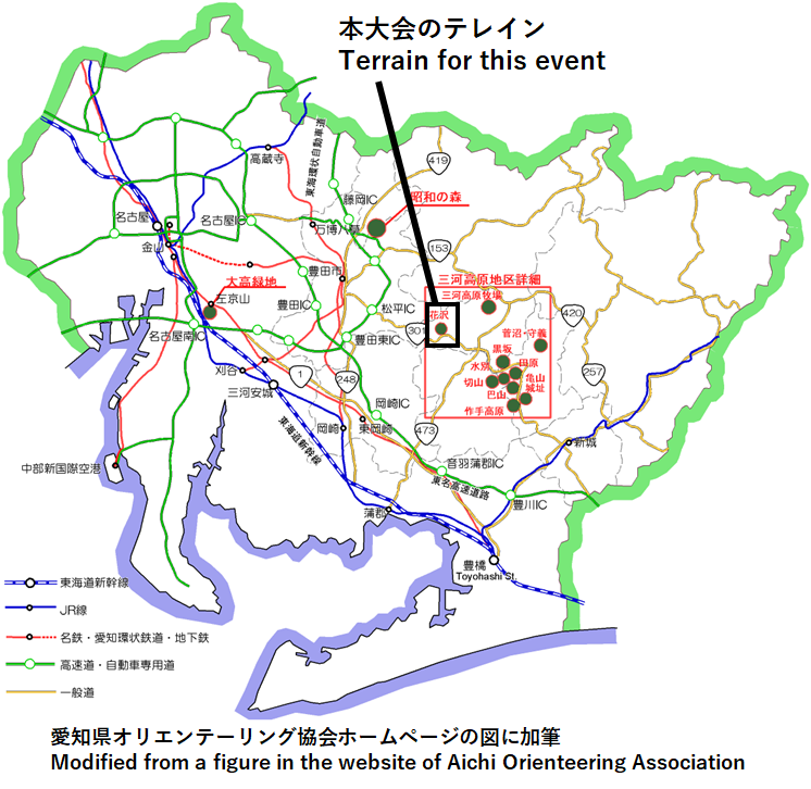
花沢は三河高原のテレインですが、
愛知県のオリエンテーリングでよく使われる作手地区とは少し距離があります。
名古屋方面から作手地区に向かうときの最後のコンビニ「ファミリーマート豊田下山店」
を利用する方は多いかと思います。
このコンビニのすぐ北が今回の競技エリアです。
皆様お馴染みの愛知県野外教育センターの北西約10kmです。
Although Hanazawa is in the Mikawa highland,
it is located at some distance from Tsukude region,
a frequently used orienteering field in Aichi Prefecture.
The competition area of this event
is immediately north to the Toyota-Shimoyama chain of Family Mart,
the last convenience store that you encounter
when you access from Nagoya side to Tsukude region,
and is approximately 10 km northwest of Aichi Outdoor Education Center
that is frequently used for an event center of orienteering in Japan.
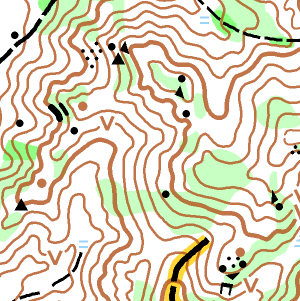
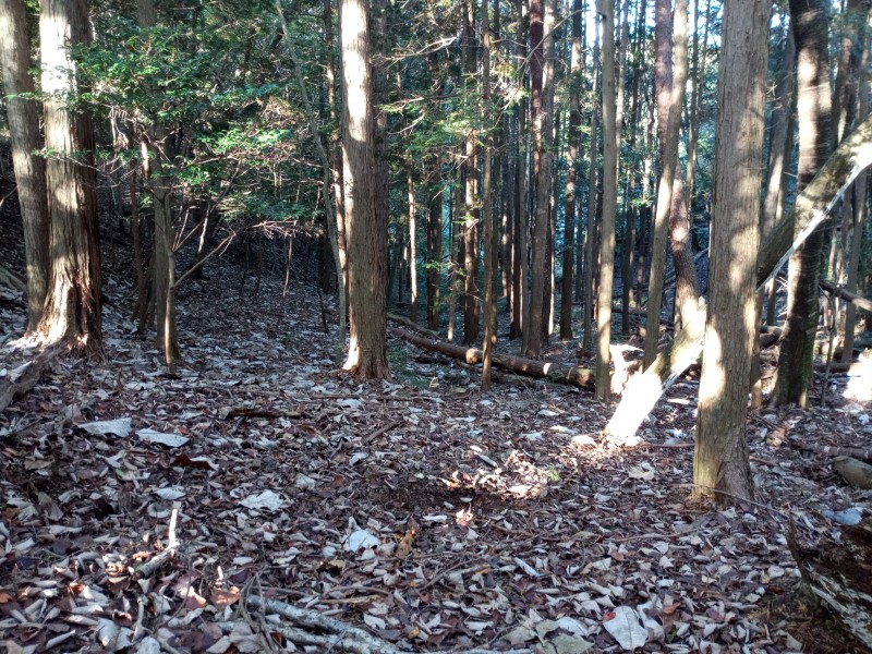
花沢の典型的な地形を下図に示します。
三河高原のテレインらしく、尾根沢が発達しています。
The figure below shows a typical topography of Hanazawa.
It consists of many ridges and valleys,
similar to other terrains in the Mikawa highland.
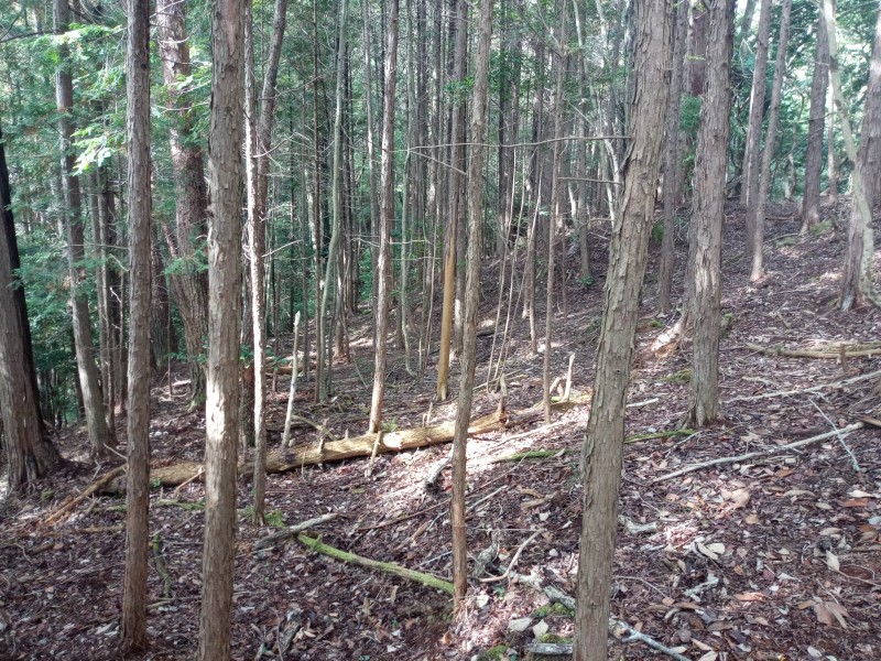
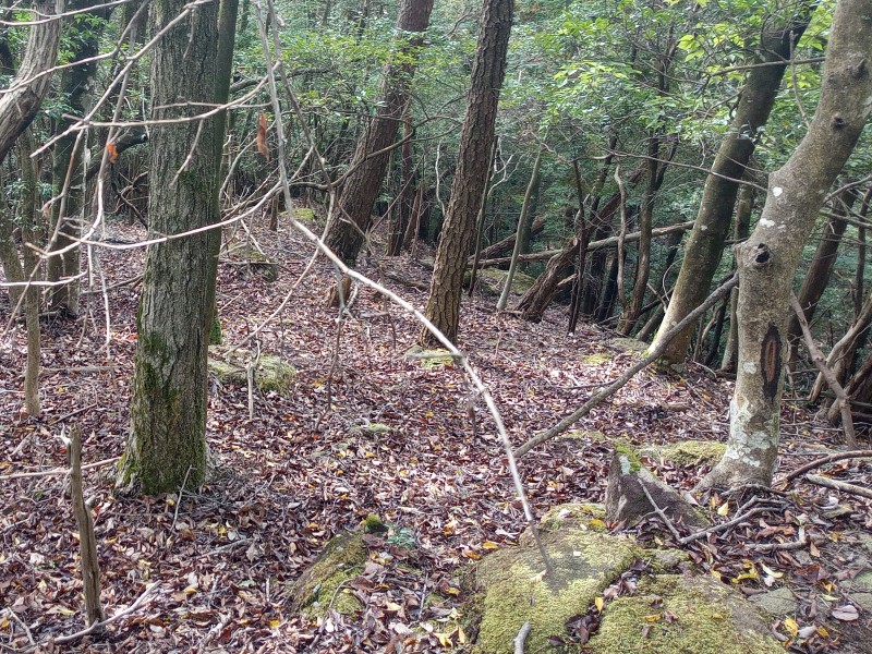
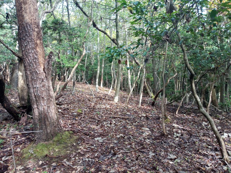
岩が多いのも花沢の特徴です。
写真のように岩が点在している場所が多く存在します。
Hanazawa is also characterized by abundant rocks.
There are many places where rocks are scattered,
as the photograph shows.
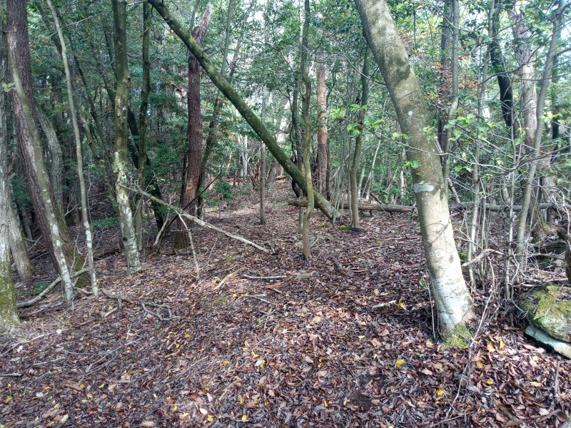
本大会の地図調査で花沢に入って驚いたのは地面を覆う笹がほとんど無いことでした。
足元がよく見えるので、隠れた倒木や岩に足をぶつけることをあまり心配せずに
スピードを上げて走れます。
このようなテレインは愛知県では珍しいように思います。
During mapping surveys, we are surprised that
there is almost no bamboo bush that cover the ground.
Lying trees and rocks are not hidden,
so that you can speed up
without worrying about hitting your foot against them.
This type of terrain is rare in Aichi Prefecture.
植生は8月に調査を始めた時点で既に良好でしたが、
秋の調査では週を追うごとに植生が良くなっていくのを肌で感じていました。
We recognized that the runnability improved week by week
during the mapping surveys in autumn,
although the runnability was already good in August
when we started the survey.
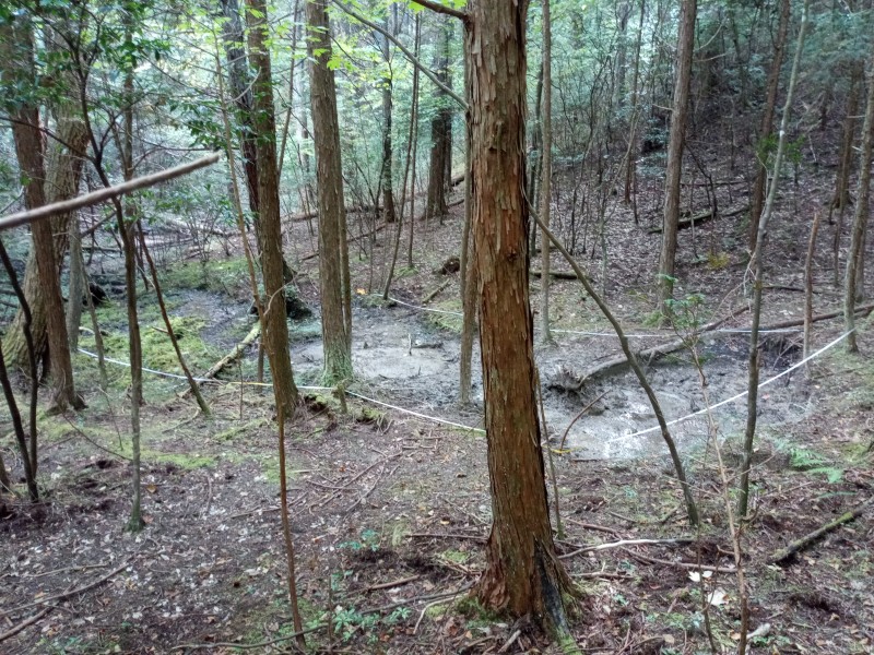
下の写真は地図調査の様子です。
巻き尺を使って沢の位置と形状を計測しているところです。
本大会では競技エリアの約半分の調査をプロマッパーに依頼し、
残りのエリアを22日かけて調査しました。
航空写真、基盤地図情報も活用しています。
狩猟期が明ける3月後半に最後の調査を行って完成させる予定です。
The photograph below shows a scene of mapping survey;
the location and geometry of a valley is measured with a tape.
Approximately half of the competition area of this event
was surveyed by a professional mapper,
and the remaining half by ourselves with as many as 22 days of surveys.
Aerial photos and basis map information are utilized.
The map is planned to be completed in this late March,
after the end of the hunting season.
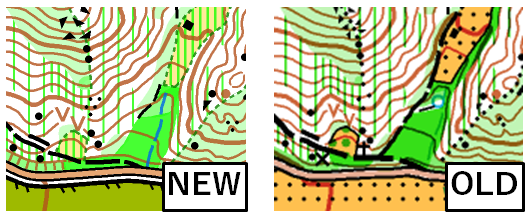
今回作成した地図のサンプルを下にお示しします。
比較のため、同じエリアの旧図も並べてみました。
読みやすくなったと思いませんか?
詳しい方はお察しの通り、読みやすさの秘訣は
最新の地図規則(ISOM2017)の「最小寸法」「最小間隔」です。
読みやすい地図で競技していただけるよう、
寸法にも注意を払いながら調査・作図を進めています。
A sample map created this time is shown below.
For comparison, an old map in the same area is shown at the right.
The comparison shows that the readability of the map improved,
owing to the minimum size and interval of symbols
regulated in the latest mapping rule (ISOM2017).
We are carefully checking the size and interval
in the mapping procedure
to make the map easily readable in high-speed competition.
花沢は愛知県屈指の「白い」テレインです。
そして季節的にも特に良好な植生が期待できます。
生まれ変わった花沢、作手地区ともまた一味違う三河高原テレインをお楽しみください。
お申込は
Japan-O-entrYから。
The runnability of Hanazawa is at the leading position in Aichi Prefecture,
and is especially good in this season.
Do not miss the opportunity to enjoy this terrain.
Register from
Japan-O-entrY.
大会公式サイトに戻る (Back to the event website)